
Anúncios
Measuring land accurately is essential for property owners, surveyors, farmers, and real estate professionals who need precise dimensions for legal, agricultural, or construction purposes.


Whether you’re planning to build a fence, calculate property taxes, determine crop yields, or verify boundaries before a purchase, understanding how to measure terrain correctly can save you time, money, and potential legal disputes. The good news is that modern technology has made this process significantly easier than ever before.
Anúncios
From traditional methods using physical tools to cutting-edge GPS applications on your smartphone, there are numerous approaches available for measuring land with varying degrees of accuracy and complexity. Let’s explore the most effective techniques for measuring terrain in different scenarios.
📏 Traditional Methods for Measuring Land
Before digital technology revolutionized land measurement, surveyors and property owners relied on physical tools and mathematical calculations. These methods are still valuable today, especially when you need to verify digital measurements or work in areas without GPS coverage.
The tape measure method remains one of the simplest approaches for smaller plots. For rectangular or square lots, you simply measure the length and width, then multiply these dimensions to calculate the total area. This works perfectly for urban lots and small yards where precision requirements aren’t extreme.
Anúncios
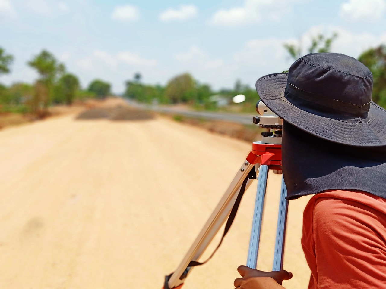
For larger properties or irregular shapes, the traditional surveyor’s wheel offers a practical solution. This device counts rotations as you walk the perimeter, converting wheel revolutions into distance measurements. Professional surveyors have used this tool for centuries with impressive accuracy.
Using Stakes and String for Boundary Marking
When measuring irregularly shaped parcels, placing stakes at corner points and connecting them with string creates a visual framework. You can then measure each segment individually and use geometric formulas to calculate the total area. This method requires basic trigonometry knowledge but provides reliable results.
For triangular sections, multiply the base by the height and divide by two. For trapezoidal areas, add the parallel sides, multiply by the height, and divide by two. Breaking complex shapes into simpler geometric forms makes calculations manageable.
🛰️ GPS Technology Revolutionizes Land Measurement
Modern GPS applications have transformed how we measure terrain, making professional-grade accuracy accessible to everyone with a smartphone. These applications use satellite positioning to track your movement as you walk property boundaries, automatically calculating area and perimeter.
GPS-based measurement apps offer several advantages over traditional methods. They work on properties of any size, from small urban lots to vast agricultural fields. The technology handles irregular shapes effortlessly, eliminating complex geometric calculations. Most importantly, measurements can be saved, shared, and referenced later.
The accuracy of GPS land measurement typically ranges from 3 to 10 meters for consumer devices, which is sufficient for most non-legal purposes. Professional-grade GPS equipment can achieve centimeter-level precision, though at significantly higher costs.

How GPS Measurement Apps Work
When you activate a GPS measurement application, your device connects to multiple satellites orbiting Earth. As you walk along property boundaries, the app records your GPS coordinates at regular intervals. These coordinate points create a digital polygon representing your land parcel.
The application then applies mathematical algorithms to calculate the enclosed area. Most apps display results in multiple units—square feet, acres, hectares, or square meters—allowing you to choose the measurement standard most relevant to your needs.
🌾 Measuring Agricultural Land and Fields
Farmers and agricultural professionals have unique measurement needs that go beyond simple area calculation. Understanding field dimensions helps optimize planting patterns, calculate seed requirements, estimate yields, and manage irrigation systems effectively.
GPS measurement applications designed for agriculture often include specialized features like row spacing calculators, planting guides, and yield estimation tools. These features transform your smartphone into a comprehensive farm management device.
When measuring agricultural land, walk the field perimeter during dry conditions when possible. Muddy or wet terrain can affect your walking pace and create GPS tracking irregularities. Early morning measurements often provide the best GPS signal quality due to atmospheric conditions.
Calculating Crop Yields Based on Land Area ✅
Once you’ve accurately measured your field, you can calculate expected yields by multiplying the area by your crop’s typical yield per unit area. This information guides purchasing decisions for seeds, fertilizers, and other inputs while helping predict harvest volumes for market planning.
For irregularly shaped fields with varying soil quality, some advanced measurement apps allow you to mark different zones and calculate their areas separately. This zoning capability enables precision agriculture techniques that optimize resource application.
🏡 Measuring Residential Properties and Lots
Homeowners frequently need property measurements for various projects—installing fences, planning gardens, calculating property taxes, or verifying lot dimensions match deed descriptions. Accurate measurements prevent costly mistakes and boundary disputes with neighbors.
Before beginning measurement, locate your property corners. Most residential lots have markers—metal stakes, concrete monuments, or marked trees—indicating boundary points. If you cannot find these markers, consult your property survey or hire a professional surveyor to identify them.
For rectangular lots, measure each side individually rather than assuming opposite sides are equal. Ground settlement, historical surveying variations, and other factors can create slight discrepancies. Recording all four sides provides complete documentation.
Dealing with Irregular Lot Shapes 🔄
Many residential properties feature irregular boundaries following roads, creeks, or historical property divisions. GPS measurement apps excel in these situations, accurately tracking curved boundaries and complex angles that would require extensive calculations with traditional methods.
When measuring curved boundaries, walk slowly and steadily to give your GPS device time to record accurate coordinate points. The more data points captured along curves, the more precisely the app can represent the boundary shape.
📐 Understanding Measurement Units and Conversions
Land measurements use various units depending on location, property type, and historical conventions. Understanding these units and their conversions ensures you communicate effectively with contractors, government offices, and other stakeholders.
In the United States, residential lots typically use square feet, while larger properties and agricultural land use acres. One acre equals 43,560 square feet or approximately 4,047 square meters. Most countries outside the US use metric measurements—square meters for smaller areas and hectares for larger parcels.
| Unit | Equivalent | Common Use |
|---|---|---|
| 1 Acre | 43,560 sq ft | US agricultural land |
| 1 Hectare | 10,000 sq meters | International standard |
| 1 Hectare | 2.471 acres | Conversion reference |
| 1 Square Mile | 640 acres | Large properties |
Why Measurement Units Matter
Using incorrect units can lead to significant errors. Confusing square feet with square yards creates a nine-fold calculation error. Mixing up acres and hectares results in a 2.5-times discrepancy. Always verify which unit system your project requires before beginning measurements.
Most modern measurement applications allow you to switch between unit systems instantly, displaying your land area in multiple formats simultaneously. This feature prevents conversion errors and helps you communicate measurements to different audiences.
🎯 Improving Measurement Accuracy
While GPS technology provides impressive accuracy for most purposes, several techniques can enhance measurement precision regardless of your chosen method. Understanding factors that affect accuracy helps you obtain the best possible results.
GPS accuracy depends heavily on satellite visibility. Tall buildings, dense tree canopy, and steep terrain can obstruct satellite signals, reducing precision. Whenever possible, conduct GPS measurements in open areas with clear sky visibility. Early morning or late afternoon often provide optimal satellite configurations.
Weather conditions also impact GPS performance. Heavy rain, snow, or dense fog can interfere with satellite signals. Ionospheric disturbances during solar storms occasionally degrade GPS accuracy. Checking GPS accuracy indicators within your measurement app helps you identify when conditions aren’t ideal.
Multiple Measurement Verification 🔍
For important measurements, conduct the process multiple times and compare results. Walk the property boundary in different directions or on different days. Consistency across multiple measurements confirms accuracy, while significant variations indicate environmental interference or technical issues.
Cross-verifying GPS measurements against traditional methods adds another accuracy layer. For example, measure one straight property line with both a GPS app and a physical tape measure. If results closely match, you can trust the GPS measurements for the entire property.
💡 Common Measurement Mistakes to Avoid
Even experienced property owners sometimes make measurement errors that lead to problems. Recognizing common mistakes helps you avoid them and ensures your measurements remain reliable and defensible.
One frequent error involves measuring the wrong boundaries. Always verify you’re measuring your actual property lines, not fence lines or tree rows that may not correspond to legal boundaries. Fences often sit several feet inside property lines, creating misleading measurements if used as boundary references.
Another common mistake is failing to account for slopes and elevation changes. GPS apps measure horizontal distance—the area projected onto a flat plane. If your property has significant slopes, the actual ground surface area exceeds the measured horizontal area. For hilly terrain, specialized surveying equipment may be necessary.
Documentation and Record Keeping 📝
Failing to properly document measurements causes headaches later. Save your GPS measurement files with clear, descriptive names including the date and property location. Take screenshots showing the measured area overlaid on satellite imagery for visual reference.
If using traditional methods, photograph your setup showing stake positions and measurement tools. Record all individual measurements in a notebook or digital document. This documentation proves invaluable when questions arise months or years later.
🏗️ When to Hire Professional Surveyors
While GPS apps and traditional methods work well for many purposes, certain situations require professional surveying services. Understanding when to hire experts prevents legal issues and ensures regulatory compliance.
Legal property transactions almost always require professional surveys. When buying or selling land, mortgage lenders and title companies typically demand certified survey documents prepared by licensed surveyors. These surveys provide legal protection and satisfy regulatory requirements that consumer measurements cannot fulfill.
Construction projects, especially those requiring building permits, usually need professional surveys. Local building departments often require site plans showing precise property boundaries, easements, setback lines, and existing structures. Only licensed surveyors can produce these legally recognized documents.
Boundary disputes with neighbors definitely warrant professional involvement. If disagreements arise about property line locations, a licensed surveyor’s determination carries legal weight that personal measurements cannot match. The surveyor’s professional liability insurance also provides protection if errors occur.
🌟 Maximizing the Value of Your Land Measurements
Accurate land measurements provide the foundation for numerous valuable applications beyond simply knowing your property size. Leveraging these measurements strategically adds significant value to property ownership and management.
Property tax assessments often rely on lot dimensions and total area. Verifying your property measurements against tax records sometimes reveals discrepancies that affect your tax liability. If tax records overstate your property size, correcting this error could reduce your annual tax bill.
Landscape and construction planning becomes far more efficient with accurate measurements. Instead of guessing material quantities, precise area calculations let you purchase exactly what you need—no wasteful excess, no inconvenient shortages. This precision saves money and prevents project delays.
Property marketing benefits greatly from detailed measurements. Real estate listings with accurate lot dimensions and area calculations attract serious buyers who appreciate thorough documentation. Providing potential buyers with measurement data demonstrates professionalism and builds confidence.
Environmental and Conservation Applications 🌱
Land measurements support conservation efforts and environmental management. Wildlife habitat restoration projects need accurate area data to calculate seed mixtures and planting densities. Conservation easements require precise boundary documentation to ensure protected areas receive proper legal status.
Watershed management and erosion control projects depend on terrain measurements to calculate runoff volumes and plan appropriate interventions. Even backyard rain gardens benefit from accurate area calculations that determine appropriate sizing for local rainfall patterns.
🚀 Future Trends in Land Measurement Technology
Measurement technology continues evolving rapidly, with exciting developments on the horizon that will make land measurement even more accessible and accurate. Staying informed about these trends helps you take advantage of new capabilities as they emerge.
Augmented reality integration represents one promising frontier. Imagine pointing your smartphone at your property and seeing boundaries, area measurements, and elevation contours overlaid on your camera view in real-time. Several companies are developing AR measurement tools that bring this vision closer to reality.
Drone technology increasingly intersects with land measurement. Consumer drones equipped with GPS and cameras can photograph entire properties from above, with specialized software processing these images to generate accurate area measurements and topographic maps. As drone prices decrease, these capabilities become accessible to more property owners.
Artificial intelligence and machine learning algorithms are improving GPS accuracy by analyzing signal patterns and correcting for environmental interference. These systems learn from millions of measurements worldwide, identifying and compensating for factors that degrade accuracy. Expect consumer GPS apps to approach professional equipment precision within coming years.
Whether you choose traditional tape measures, GPS smartphone apps, or professional surveying services, accurate land measurement provides essential information for property management, construction planning, agricultural operations, and legal documentation. Modern technology has democratized measurement capabilities that once required expensive equipment and specialized expertise, putting professional-grade tools in everyone’s hands.
Start with clear objectives about why you need measurements and what accuracy level your purpose requires. Select appropriate tools and methods for your specific situation, understanding both capabilities and limitations. Document everything thoroughly, creating records that remain valuable for years to come. With these principles in mind, you’ll measure your land confidently and accurately, whether managing a small urban lot or extensive agricultural acreage.