
Anúncios
Measuring land accurately is essential for property owners, farmers, architects, and real estate professionals who need precise dimensions for planning and legal purposes.


Whether you’re purchasing property, planning a construction project, or managing agricultural land, understanding how to measure terrain correctly can save you time, money, and potential legal complications. The advancement of technology has transformed traditional surveying methods, making land measurement more accessible than ever before.
Anúncios
From ancient civilizations using ropes and stakes to modern GPS-enabled smartphones, the evolution of land measurement techniques reflects humanity’s constant need for accuracy in defining boundaries and calculating areas. Today’s tools combine traditional surveying principles with cutting-edge technology to deliver professional-grade results.
📏 Understanding the Basics of Land Measurement
Land measurement involves determining the dimensions, area, and boundaries of a specific plot or terrain. This process requires understanding various units of measurement and the relationship between perimeter and area calculations.
The most common units used in land measurement include square feet, square meters, acres, and hectares. In the United States, acres remain the standard unit for larger properties, while square feet are used for smaller parcels. Internationally, the metric system dominates with square meters and hectares being the preferred measurements.
Anúncios
Before beginning any measurement project, you need to identify the property corners and boundary markers. These reference points serve as the foundation for all subsequent calculations and ensure that your measurements align with legal property descriptions.
🛠️ Traditional Methods for Measuring Terrain
Traditional land surveying techniques have been used for centuries and remain relevant today, especially for official legal documentation and boundary disputes. These methods require specific tools and expertise but deliver highly accurate results.
Using Measuring Tape and Chains
The simplest approach involves using a measuring tape or surveyor’s chain to physically measure the distances between property corners. This method works well for small, rectangular plots with clear boundaries and level terrain.
To measure using this method, start at one corner and stretch the tape to the next corner, keeping it taut and level. Record each measurement carefully, noting any obstacles or irregularities in the boundary line. For larger properties, this process can be time-consuming and may require multiple people to ensure accuracy.
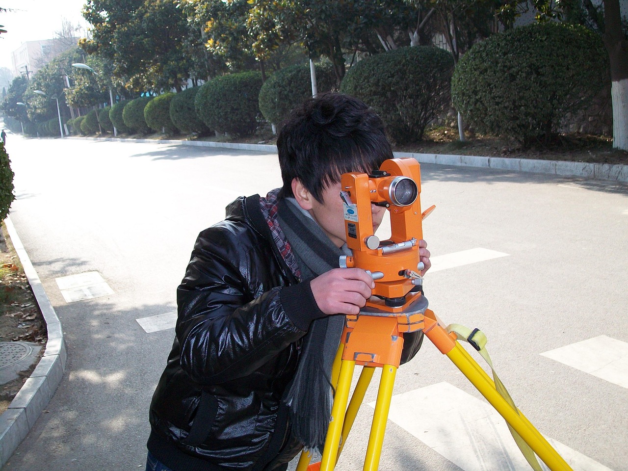
Theodolite and Total Station Surveying
Professional surveyors use theodolites and total stations to measure angles and distances with exceptional precision. These instruments combine electronic distance measurement with angle calculations to create detailed property maps.
A theodolite measures horizontal and vertical angles, while a total station adds electronic distance measurement capabilities. These tools are essential for complex terrain, irregular boundaries, or properties requiring legal documentation for sales or construction permits.
📱 Modern Digital Solutions for Land Measurement
Technology has revolutionized land measurement, making it accessible to property owners and professionals without specialized surveying equipment. GPS-enabled smartphones and dedicated apps now offer remarkable accuracy for most practical purposes.
Mobile applications use satellite positioning technology to track your movement around a property’s perimeter. As you walk the boundaries, the app records coordinates and automatically calculates the total area, perimeter length, and even elevation changes in some cases.

These digital tools offer several advantages over traditional methods, including speed, ease of use, and the ability to save and share measurements instantly. They’re particularly useful for agricultural land management, real estate evaluation, and preliminary planning before professional surveys.
🌍 GPS Technology in Land Measurement
Global Positioning System technology has transformed how we approach land measurement. GPS receivers communicate with satellites orbiting Earth to determine precise coordinates anywhere on the planet.
Modern smartphones contain GPS chips that can achieve accuracy within 3-5 meters under optimal conditions. When combined with correction services and proper measurement techniques, this accuracy improves significantly, making GPS suitable for many professional applications.
How GPS Measurement Apps Work
GPS measurement applications track your position as you walk around the perimeter of a property. The app records latitude and longitude coordinates at regular intervals, creating a digital polygon that represents the land boundary.
Once you’ve completed the perimeter walk, the application uses geometric formulas to calculate the enclosed area. Advanced apps also provide additional features like distance measurement between points, compass bearings, and the ability to mark specific features within the property.
Factors Affecting GPS Accuracy
Several environmental and technical factors influence GPS measurement accuracy. Understanding these variables helps you achieve the best possible results when measuring terrain with digital tools.
- Satellite visibility and signal strength directly impact accuracy
- Tall buildings, dense forests, or steep terrain can obstruct GPS signals
- Weather conditions, particularly heavy cloud cover, may reduce precision
- The quality of your device’s GPS receiver affects measurement reliability
- Walking speed and consistency influence the number of coordinate points captured
🏡 Step-by-Step Guide to Measuring Your Land
Whether you choose traditional methods or modern GPS technology, following a systematic approach ensures accurate and reliable measurements. Preparation and attention to detail make the difference between useful data and frustrating results.
Preparation and Planning
Begin by gathering any existing property documents, including deeds, surveys, or plat maps. These documents provide valuable reference information and help you identify official property corners and boundaries.
Walk the property perimeter beforehand to familiarize yourself with the terrain and identify any obstacles or access issues. Look for existing boundary markers, such as iron pins, concrete monuments, or fence posts that may indicate property corners.
Executing the Measurement
For GPS-based measurements, start at a clearly defined corner of the property. Open your measurement application and begin tracking. Walk slowly and steadily along the property boundary, keeping the device stable and at a consistent height.
Pay special attention to corners and boundary changes. Some applications allow you to mark specific points manually, which helps create a more accurate polygon, especially for properties with irregular shapes or numerous corners.
Continue walking until you return to your starting point, completing the enclosed perimeter. Most apps will automatically close the polygon and calculate the area once you’ve returned to the beginning.
Verifying Your Results
After completing your measurement, compare the results with any existing documentation. Minor discrepancies are normal due to differences in measurement methods and accuracy levels, but significant variations may indicate errors.
Consider measuring the property multiple times from different starting points or on different days. Averaging multiple measurements can improve overall accuracy and help identify any systematic errors in your technique.
🌾 Practical Applications of Land Measurement
Accurate terrain measurement serves numerous purposes across different industries and personal needs. Understanding these applications helps you choose the appropriate measurement method and accuracy level for your specific situation.
Agricultural Land Management
Farmers rely on precise field measurements to calculate seed requirements, fertilizer applications, and irrigation needs. Knowing the exact acreage of each field section enables efficient resource allocation and cost management.
GPS measurement tools allow farmers to track field boundaries, calculate planted areas, and monitor changes over time. This information integrates with precision agriculture systems to optimize crop yields and reduce environmental impact.
Real Estate Transactions
Property buyers and sellers need accurate land measurements to determine fair market value and negotiate prices. While professional surveys are typically required for legal transactions, preliminary measurements help establish realistic expectations.
Real estate agents use land measurement tools to provide accurate property information in listings and marketing materials. Quick area calculations help compare similar properties and identify the best value for clients.
Construction and Development Planning
Architects, builders, and developers require precise site measurements during the planning phase of construction projects. These measurements inform building placement, site grading, drainage planning, and compliance with setback requirements.
Initial GPS measurements provide the foundation for detailed architectural surveys and engineering studies. They help identify potential site challenges early in the development process, reducing costly surprises during construction.
🎯 Choosing the Right Measurement Method
Selecting the appropriate land measurement technique depends on several factors, including required accuracy, property size, terrain complexity, and intended use of the measurements.
| Method | Accuracy | Best For | Cost |
|---|---|---|---|
| Measuring Tape | High (small areas) | Small, rectangular plots | Low |
| GPS Apps | Medium to High | Large irregular properties | Very Low |
| Professional Survey | Very High | Legal documentation | High |
| Drone Mapping | Very High | Complex terrain, large areas | Medium to High |
For casual measurements, property planning, or agricultural management, GPS-based smartphone applications offer an excellent balance of accuracy, convenience, and cost. These tools provide sufficient precision for most non-legal purposes while delivering results in minutes rather than hours.
⚠️ Common Mistakes to Avoid
Even with advanced technology, land measurement errors can occur. Recognizing common pitfalls helps you achieve more reliable results and avoid costly mistakes.
Ignoring Property Boundaries
One of the most frequent errors involves measuring the wrong boundaries. Always verify that you’re measuring the actual property line, not a fence line or other feature that may not align with legal boundaries. Fences, hedges, and tree lines often sit inside or outside the true property boundary.
Poor GPS Signal Conditions
Attempting to measure under dense tree canopy, near tall buildings, or during severe weather can significantly reduce GPS accuracy. Choose clear weather and optimal satellite visibility for the most reliable measurements.
Inconsistent Walking Speed
Walking too quickly or erratically while using GPS measurement apps reduces the number of coordinate points captured, leading to less accurate area calculations. Maintain a steady, moderate pace throughout the measurement process.
💡 Tips for Maximum Accuracy
Implementing best practices when measuring land significantly improves the reliability and usefulness of your results, regardless of the method you choose.
Always calibrate your GPS device or app before beginning measurements. Many applications include calibration routines that improve accuracy by accounting for local magnetic variations and signal conditions.
Measure during optimal conditions whenever possible. Mid-morning to early afternoon typically offers the best satellite visibility and signal strength. Avoid measuring during heavy rain, snow, or immediately after significant weather events.
Take multiple measurements from different directions or at different times. Averaging several independent measurements reduces random errors and provides more confidence in your final results.
Document your measurements thoroughly, including date, time, weather conditions, and any notable features or obstacles encountered. These notes prove invaluable when reviewing measurements later or comparing results with professional surveys.
🔄 Converting Between Measurement Units
Understanding unit conversions is essential when working with land measurements, especially when dealing with international properties or comparing measurements from different sources.
One acre equals 43,560 square feet or approximately 4,047 square meters. A hectare, the metric equivalent commonly used internationally, equals 10,000 square meters or about 2.47 acres.
Most GPS measurement apps automatically convert between different units, but understanding these relationships helps you verify calculations and communicate effectively with professionals who may use different systems.
🚀 Future of Land Measurement Technology
Emerging technologies continue to improve the accessibility and accuracy of land measurement. Augmented reality applications now overlay property boundaries on live camera views, helping visualize property lines in real-time.
Drone technology combined with photogrammetry software creates highly accurate 3D terrain models and measurements. These systems capture topographic details impossible to measure with traditional ground-based methods.
Artificial intelligence and machine learning algorithms improve GPS accuracy by learning from environmental conditions and historical measurement data. Future applications will likely achieve survey-grade accuracy using consumer devices.
🎓 Understanding Legal Considerations
While modern measurement tools provide impressive accuracy, they may not satisfy legal requirements for property transactions, boundary disputes, or construction permits. Most jurisdictions require licensed professional surveyors for official documentation.
Use GPS measurements for planning, estimation, and personal knowledge, but consult with licensed surveyors before making legal decisions based on these measurements. Professional surveys include legal descriptions, certified accuracy statements, and liability coverage that informal measurements cannot provide.
Keep records of all measurements, including digital files, screenshots, and written notes. These records can support professional surveys, help resolve minor boundary questions, and provide valuable property information for future reference.
✨ Making Land Measurement Simple and Accessible
Modern technology has democratized land measurement, putting professional-grade tools in everyone’s pocket. What once required expensive equipment and specialized training now happens with a smartphone and a few minutes of walking.
Whether you’re managing farmland, evaluating a potential property purchase, or planning a backyard project, accurate terrain measurement provides the foundation for informed decisions. The combination of GPS technology, intuitive applications, and proven surveying principles delivers results that serve countless practical purposes.
By understanding the available methods, choosing appropriate tools for your needs, and following best practices for accuracy, you can confidently measure land for most everyday applications. Remember that while technology provides excellent results for general purposes, professional surveys remain essential for legal matters and complex projects.
Start with simple measurements to build confidence, experiment with different apps to find the one that works best for your needs, and always prioritize accuracy over speed. With practice, land measurement becomes a straightforward task that empowers you with valuable property knowledge and planning capabilities.