
Anúncios
Measuring land areas has never been easier thanks to modern mobile technology and specialized apps designed to calculate terrain dimensions with impressive accuracy.


Whether you’re a real estate professional, farmer, landscaper, or property owner, having the ability to measure land directly from your smartphone transforms how you work and plan. Gone are the days when you needed expensive surveying equipment or professional help for basic land measurements.
Anúncios
The evolution of GPS technology combined with sophisticated mobile applications has democratized land measurement, making it accessible to everyone. These innovative tools leverage satellite positioning and advanced algorithms to deliver results that are surprisingly accurate for most practical purposes. 📱
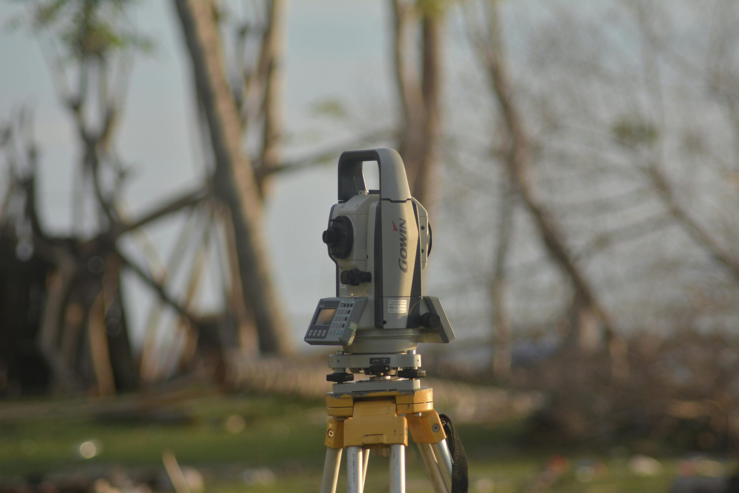
Why Traditional Land Measurement Methods Are Becoming Obsolete
For centuries, land measurement relied on physical tools like measuring tapes, chains, theodolites, and other surveying equipment. While these methods provided accurate results, they came with significant drawbacks that made them impractical for everyday use.
The process was time-consuming, often requiring multiple people to complete measurements accurately. Professional surveyors charged substantial fees, making even simple property assessments expensive. Weather conditions could delay work, and dense vegetation or rough terrain created additional complications.
Anúncios
Modern terrain measuring apps eliminate most of these challenges. They work in virtually any weather condition, require only one person to operate, and deliver instant results without the need for specialized training. The cost difference is dramatic—instead of paying hundreds or thousands for professional surveys, you invest once in an app or use free alternatives.
How Terrain Measuring Apps Actually Work 🛰️
Understanding the technology behind these applications helps you appreciate their capabilities and limitations. Most terrain measuring apps rely on GPS (Global Positioning System) and GNSS (Global Navigation Satellite System) technology to determine your precise location on Earth.
When you walk around a property’s perimeter with your smartphone, the app records GPS coordinates at regular intervals or at points you manually mark. These coordinate points create a polygon that represents the boundary of the measured area. The app then applies mathematical formulas to calculate the enclosed area.
Advanced apps enhance basic GPS data with additional features like aerial imagery integration, topographic information, and correction algorithms that improve accuracy. Some applications use differential GPS techniques or connect to ground-based reference stations to achieve professional-grade precision.
The accuracy of these measurements typically ranges from 1 to 5 meters under normal conditions, which is sufficient for most agricultural, real estate, and landscaping purposes. Premium apps with advanced correction features can achieve sub-meter accuracy comparable to entry-level professional equipment.
Essential Features to Look for in a Land Measurement App
Not all terrain measuring applications are created equal. The best ones combine user-friendly interfaces with powerful features that enhance both accuracy and functionality. Here’s what separates exceptional apps from basic ones:
- Multiple measurement units: The ability to display results in acres, hectares, square meters, square feet, and other units ensures compatibility with your regional standards and preferences.
- Save and export capabilities: Professional users need to save measurements, add notes, and export data in formats like PDF, KML, or CSV for documentation and sharing.
- Offline functionality: Many properties lack cellular coverage, making offline operation essential for fieldwork in remote locations.
- Map overlay options: Viewing your measurements on satellite imagery or topographic maps provides valuable context and helps identify landmarks.
- Perimeter calculation: Beyond area, knowing the boundary length is crucial for fencing projects, property line identification, and cost estimation.
- Point marking flexibility: The best apps allow both manual point placement and automatic tracking as you walk, accommodating different measurement scenarios.
- Shape editing tools: The ability to adjust, add, or remove points after initial measurement helps correct mistakes without starting over.
Real-World Applications That Benefit from Mobile Land Measurement 🌾
The versatility of terrain measuring apps extends across numerous industries and personal use cases. Understanding these applications helps you recognize opportunities where these tools can simplify your work or projects.
Agriculture and Farming
Farmers use measurement apps to calculate field sizes for crop planning, irrigation system design, and fertilizer application rates. Knowing exact acreage helps optimize seed purchases, predict harvest yields, and manage resources efficiently. Livestock operations benefit from pasture rotation planning and grazing area management.
Real Estate and Property Development
Real estate agents can quickly assess property sizes during site visits, verify listing information, and provide clients with accurate measurements without waiting for formal surveys. Property developers use these tools for preliminary site assessments, feasibility studies, and planning before investing in detailed professional surveys.
Landscaping and Garden Design
Landscape professionals calculate areas for lawn installation, mulch coverage, paving projects, and irrigation planning. Accurate measurements translate directly into material cost estimates and project quotes. Homeowners planning garden renovations benefit from knowing exact dimensions for purchasing materials.
Construction and Engineering
While construction projects require certified surveys for legal purposes, measurement apps serve valuable roles in preliminary site evaluation, material estimation, and project visualization. They help construction managers verify site conditions and identify potential challenges before detailed planning begins.

Maximizing Accuracy: Best Practices for Using Measurement Apps
Even the most sophisticated app produces unreliable results when used incorrectly. Following proven techniques ensures you get the most accurate measurements possible from your smartphone.
Start by ensuring your device has a clear view of the sky. GPS signals come from satellites, and obstructions like buildings, dense tree canopy, or steep terrain can degrade signal quality. Open areas provide the best conditions for accurate positioning.
Walk slowly and steadily around the property perimeter, holding your phone in a consistent position. Erratic movements or varying phone angles can introduce measurement errors. For best results, hold the device at chest height with the screen facing up.
Mark corner points carefully when using manual point placement mode. Take a moment at each corner to ensure the app registers your exact position before moving to the next point. Rushing through corner marking is a common source of inaccuracy.
Calibrate your device’s compass before starting measurements. Most apps include calibration instructions—typically requiring you to move your phone in a figure-eight pattern. Proper compass calibration improves directional accuracy.
Consider taking multiple measurements and averaging the results for critical applications. GPS accuracy varies based on satellite positions, atmospheric conditions, and other factors. Multiple measurements reduce the impact of temporary variations.
Understanding Limitations and When to Call Professionals 📏
While terrain measuring apps offer remarkable capabilities, recognizing their limitations prevents problems and ensures you use the right tool for each situation. Certain scenarios demand professional surveying despite the convenience of mobile apps.
Legal property boundary determinations require licensed surveyors in virtually all jurisdictions. Apps cannot establish legally defensible property lines, resolve boundary disputes, or satisfy requirements for property transactions, subdivision, or construction permits.
Highly irregular or complex-shaped properties challenge app accuracy. Properties with numerous small sections, curved boundaries, or intricate features may need professional measurement for reliable results. The more complex the shape, the greater the potential for cumulative errors.
Situations requiring centimeter-level precision exceed typical app capabilities. Engineering projects, construction staking, and detailed site planning need professional-grade equipment. Using app measurements for these purposes risks costly mistakes.
Dense urban environments with tall buildings can create “urban canyon” effects that degrade GPS accuracy significantly. The satellite signals reflect off structures, creating multipath errors that confuse positioning systems. Professional surveyors use alternative methods less affected by these conditions.
Cost Comparison: Apps vs Traditional Surveying Services
Understanding the financial implications helps you make informed decisions about when apps suffice and when professional services justify their higher cost.
| Service Type | Typical Cost | Accuracy Level | Best Use Cases |
|---|---|---|---|
| Measurement App | $0-$30 one-time | 1-5 meters | Planning, estimates, informal measurements |
| Basic Land Survey | $500-$1,500 | 0.01-0.1 meters | Property transactions, simple boundaries |
| Complex Survey | $1,500-$5,000+ | 0.001-0.01 meters | Legal disputes, construction, subdivisions |
| Topographic Survey | $2,000-$10,000+ | 0.01-0.05 meters | Engineering, detailed site planning |
For preliminary assessments, rough estimates, and non-legal purposes, apps deliver tremendous value. A $20 app that you use dozens of times easily justifies itself compared to even a single professional survey costing hundreds of dollars.
Privacy and Data Security Considerations 🔒
Modern apps often request access to location services, storage, and sometimes internet connectivity. Understanding what data these applications collect and how they use it protects your privacy and property information.
Review app permissions before installation. Legitimate measurement apps need GPS access for obvious reasons, but question why an app might request contacts, camera, or other unrelated permissions. Unnecessary permission requests may indicate privacy concerns.
Check the developer’s privacy policy to understand data collection practices. Some apps upload measurement data to cloud servers for backup or sync features, while others keep everything local to your device. Choose apps whose data handling aligns with your privacy preferences.
For sensitive properties or confidential projects, consider apps that function entirely offline and store data only on your device. This approach eliminates concerns about data transmission or cloud storage security.
Be cautious about sharing measurement data, especially when it reveals property boundaries, dimensions, or locations. This information could have value to competitors, criminals planning theft, or others with malicious intent.
Future Developments in Mobile Land Measurement Technology
The field of mobile measurement continues evolving rapidly, with emerging technologies promising even greater accuracy and functionality. Understanding these trends helps you anticipate what’s coming and plan accordingly.
Multi-frequency GNSS receivers in smartphones represent a significant advancement. Newer phones can receive signals from multiple satellite constellations (GPS, GLONASS, Galileo, BeiDou) on different frequencies, dramatically improving accuracy and reliability. This technology, once exclusive to professional equipment, is becoming mainstream in consumer devices.
Augmented reality integration will transform how we visualize measurements. Imagine pointing your phone at a property and seeing boundary lines, area calculations, and measurements overlaid on the live camera view. Several apps are already experimenting with AR features that make measurements more intuitive and easier to understand.
Artificial intelligence and machine learning are being applied to GPS correction. Advanced algorithms can learn typical error patterns in specific locations and automatically apply corrections, pushing accuracy closer to professional levels without additional hardware.
Drone integration offers exciting possibilities for measuring large or inaccessible properties. Some apps now support importing data from drone surveys, combining aerial mapping with ground-based GPS measurements for comprehensive property analysis.
Making the Smart Choice for Your Measurement Needs ✅
Selecting the right approach to land measurement depends on your specific requirements, budget, and accuracy needs. For most everyday applications—from farm field calculations to landscaping estimates—modern terrain measuring apps provide an excellent balance of convenience, accuracy, and affordability.
These tools empower property owners, agricultural professionals, and outdoor enthusiasts to measure land quickly and accurately without expensive equipment or specialized training. The technology has matured to the point where smartphone-based measurements rival entry-level professional equipment for many practical purposes.
Start with a well-reviewed app that matches your needs, learn proper measurement techniques, and understand both capabilities and limitations. For informal measurements, planning, and estimates, you’ll find these apps remarkably capable. When legal precision or certified results are required, recognize that professional surveyors remain essential.
The democratization of land measurement technology represents a genuine breakthrough, placing powerful surveying capabilities in everyone’s pocket. By combining the convenience of mobile apps with knowledge of when professional services are necessary, you can approach land measurement projects with confidence and achieve accurate results efficiently and economically.